Lough Ramor Loop
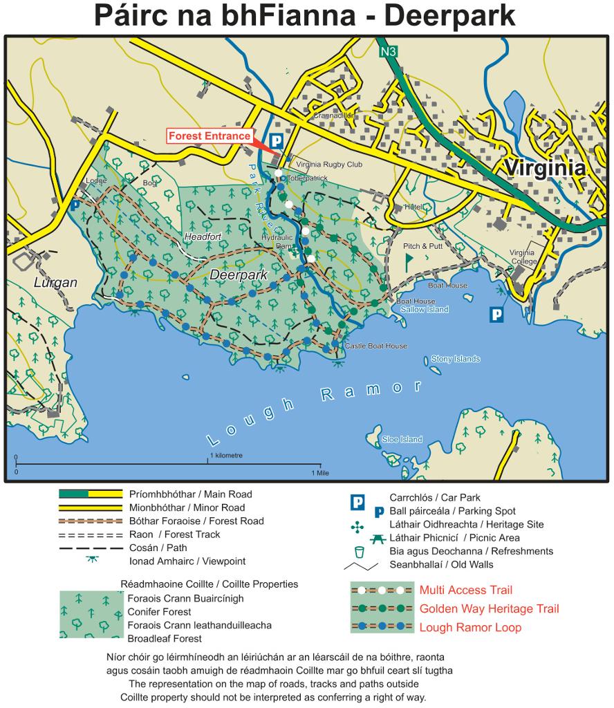
The forest's longest walk, about 4.2 km (roughly an hour, graded easy), runs along the park river and the shores of Lough Ramor. Locally it also forms a 5.5 km Slí na Sláinte route starting and finishing at the forest entrance.
A 160-hectare Coillte forest on the edge of Virginia, where easy waymarked trails thread old broadleaf woodland and follow the shores of Lough Ramor.
The forest's longest walk, about 4.2 km (roughly an hour, graded easy), runs along the park river and the shores of Lough Ramor. Locally it also forms a 5.5 km Slí na Sláinte route starting and finishing at the forest entrance.
A 2.1 km easy loop (about an hour) linking the best of the forest's built heritage: Toberpatrick well, Lady's Cottage, the Castle boathouse and the stone and metal bridges, through biodiverse broadleaf woodland.
A 1.1 km trail built to multi-access standard runs from the car park to the stone bridge across the park river. It is the best choice for wheelchairs and buggies, as some of the narrower river and lake paths are not buggy-suitable.
The 160 ha forest mixes broadleaf, conifer and mixed woodland of varying ages, some planted by the Marquis of Headfort over a century ago, with a large portion managed for biodiversity and a rich understory.
The main wider paths are flat and forgiving, making this a good first walk for small children. Bring a picnic, wellies and a raincoat, as tracks can be muddy after rain.
The forest sits just outside Virginia, where you will find cafés, pubs and restaurants, plus Virginia Golf Course, the Ramor Theatre and the Lough Ramor shoreline.
Load the interactive map to explore this place location.